Croydon's cycle network
Strategic Cycle Routes
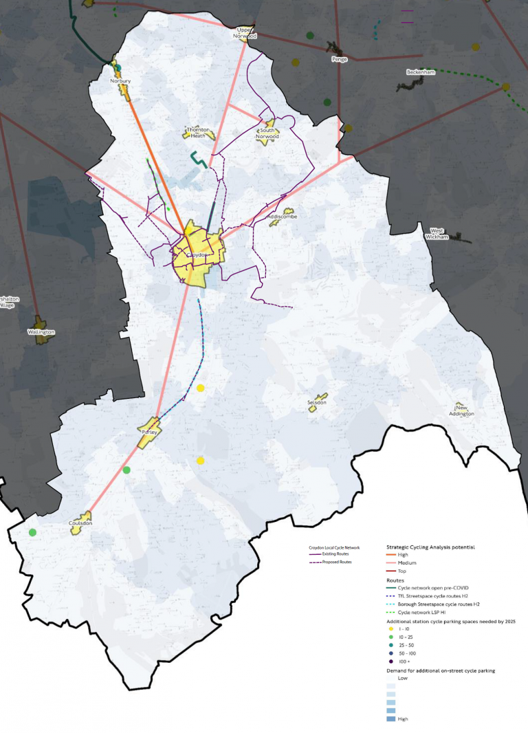
A safe cycling network is a being established across Croydon. These routes are based on Transport for London’s most recent Strategic Cycling Analysis to plan a coherent cycle network across London. This network includes protected routes on busier roads and unprotected routes on quieter streets and in parks.

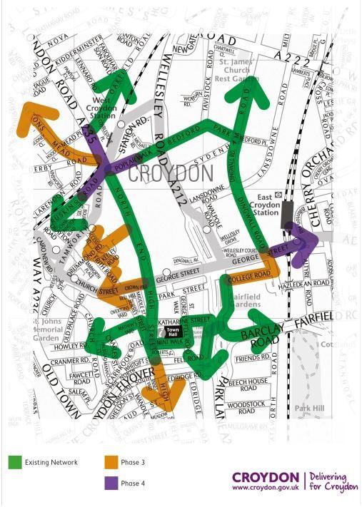
Town centre cycle loop
The projects forms part of a series of interlinked schemes in the town centre that create a safe cycle ‘loop’ around the town centre and access to cycle routes out of the town centre to other parts of Croydon. The proposed route is:
Poplar Walk - Bedford Park - Dingwall Road - College Road - Fairfield Halls - Katharine Street - Fell Road - Mint Walk - High Street - North End.

Aims of these projects
In reallocating roadspace in line with government guidance we aim to:
- Unlock Croydon’s cycling and walking potential
- Make contribution to the Council’s climate emergency response by encouraging more sustainable methods of travel like cycling or walking
- Addressing concerns around air pollution
- Helping to ensure every journey is made safely including those by car, bicycle and foot
- Encourage and enable increased physical activity to address concerns about poor physical health and obesity
England’s urban roads are filling up. Between 2010 and 2019, traffic in urban areas grew by a quarter. Even before the pandemic, road traffic was predicted to grow up to 51% by 20501. Trends since, with the increase in delivery traffic and the (hopefully temporary) move away from public transport, are likely to further increase road demand in the short term.
In 2018, vehicles on Croydon’s roads emitted 251,000 Tons of CO2, more than in any other London borough. To combat this the Mayor’s of London has set a target that 80 per cent of all trips in London will be made by walking, cycling or public transport by 2041.
